
Wells County, North Dakota
Population 1920, U.S. Census, 12,957
Male 6,985
Female 5,972
Families 2,620
Dwellings 2,551
Farms 1,620
Schools 106
Population 1925, State Census, 13,208
Density of population 10.2 persons per square mile.
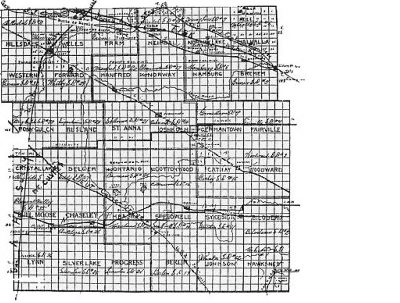
Wells County is one of the fifty-three counties of North Dakota and is slightly east of the geographical center of the state. It is bounded on the north by Pierce and Benson counties, on the east by Eddy and Foster counties, on the south by Stutsman and Kidder counties, and on the west by Sheridan county. The county is thirty-six miles or six townships square and contains thirty-six congressional townships. According to the United States Land Survey thereof, the county contains 1,296 square miles or 823,916.93 acres of land of which 869.36 acres is water surface. There are 1,296 sections of land or 5,184 quarter section farms.
It belongs to the rolling prairie of glaciated region of North Dakota and has an elevation of from 1,550 feet on the level prairie to some 2,000 feet in the Coteau regions. It is situated between townships 144 and 151 north and ranges 67 and 74 west, and midway between the 47th and 48th degrees of north latitude. The eleventh standard parallel forms the southern boundary of the county, and the twelfth standard parallel is the township line where the one and one-half mile jog or correction line throws the two north tiers further west.
The 10th Guide Meridian is the west boundary of the county. The 100th degree of West Longitude extends through the county midway between Harvey and the Wells-Sheridan county line.
It would be an exact rectangle if it were not for the correction lines. These correction lines are parallels used for a new base in laying out townships, when surveying government lands in the United States. Their adoption is necessitated at certain intervals by the convergance of the meridians and the statute requirements that the townships be square.
There are three rivers: the Pipestem, which rises in the Coteaus southwest of Heaton, and the James and Sheyenne, which rise nearly side by side in the Coteaus near the Wells and Sheridan line and flow in an easterly direction for many miles before separating. The waters of the James eventually reach the Gulf of Mexico while those of the Sheyenne flow on to Hudson Bay. Their impulses are very emblematic of the course pursued by many families of the human race.
In the east central part of the county is a creek called Rocky Run and the village of Cathay is situated on its south bank. It is a small tributary of the James River and extends in a westerly direction nearly halfway across the county. It was named in 1882 by Edmund Spokesfield, and the name being suggested by the vast accumulation of rocks on its banks.
The height of land is found in the narrow stretch of land between the James and Sheyenne River valleys.
When Glacial Lake Souris overflowed, its waters reached the Sheyenne River through the Big Coulee and Girad and Buffalo lakes.
A well marked channel, a half mile in width, leads across from the Sheyenne to the James River in the vicinity of Heimdal. This old channel is now in a “Dry Waterway”. In time of high water, there is a stream in the bottom, flowing toward the Sheyenne. The valley of the Sheyenne is deeper and larger then that of the James.
Pony Gulch is another old channel of the Glacial Period.
The Coteaus are a range of a low hills dotted with small lakes. Wells County is situated in the “bowl of the grain belt” and “cream can” section of North Dakota, and is one of the very best agricultural, stock raising and diversified farming counties of the state.
.It is in the upper James and Sheyenne river regions. The territory embraced in the county was long included in the hunting grounds of Indian tribes. The French Voyageurs were early visitors there in the long ago. Its grounds were hunted over by the Hudson Bay Company hunters, with the Red River buffalo hunters from Pembina, and the fur hunters from the trading posts along the Missouri river.
The Yanktonai Indian tribe laid claim to all the territory west of the James river on a line with Devils Lake, and extending to the Missouri and White Earth Rivers, which they relinquished to the United States under the terms of the Dakota and Yankton treaties, signed April 29, 1868, and completed at Fort Rice in the June of that year.
This treaty is known as the Ft. Laramie or General Sherman treaty.
North Dakota was included in the Louisiana Purchase made from France in 1803. However the English long claimed all of the country drained by the Red, Sheyenne and the Mouse Rivers and their tributaries until 1818, when a treaty was signed and the 49th Parallel became the International Boundary line. Consequently, the Sheyenne river territory in Wells County was once claimed as British possessions, while the remainder of the county belonged to the French.
The territory now embraced in Wells County was included in Pembina County, Minnesota, one of the four first counties created by the first Territorial Legislature of Minnesota in 1849.
In 1870 two counties, Pembina and Buffalo, were created by the Territorial Legislature of Dakota in session at Yankton. Pembina County extended west from the Red River of the North to the 9th Guide Meridian and Buffalo from the 9th Guide Meridian to the Missouri and White Earth rivers and both south from the Canadian Boundary to the 46th parallel of North Latitude. The 9th Guide Meridian is the township line between Ranges 66 and 67, and extends north and south through the present cities of New Rockford and Carrington. The Buffalo county was named on account of the countless herds of buffalo, the wild cattle of the prairie, that roamed and grazed over its prairies.
Buffalo county never was organized as a county and passed out of existence after many others, including Wells, had been carved from its vast area.
On January 4, 1873, Wells County was created by the Act of the 10th Territorial Legislative Assembly of Dakota, then in session at Yankton, and named Gingras (Jennegra) county in honor of Antoine Blanc Gingras of St. Joseph, now Walhalla. The county name (Gingras), was proposed by the noted the territorial statesman: Col. Enos Stutsman, Yankton and Pembina pioneer, then serving his last term in the legislature as a member of the Council, from Pembina district. It was adopted by the Assembly and approved by Governor John A. Burbank. Gingras County was never organized.
Antoine B. Gingras
Antoine B Gingras was born in 1821, of French and Chippewa Indian parentage. He came to Pembina from the Lake Superior Regions about 1850, and soon after engaged in the Indian trade there and at St. Joseph. He later operated a Red River cart line between St. Joseph and St. Paul and then became associated with Norman W. (Commodore) Kittson, in operating a cart line between Winnipeg and St. Paul. He was described to by historians of his day, as fat and jolly and very shrewd and successful in business. Statisticians then rated him as the richest man in Northern Dakota, and the worth some $60,000.00. In 1852, he was elected a member of the lower house of the Minnesota Territorial Legislature from the Pembina district. Mr. Kittson was elected, at the same time, to membership in the upper house.
Antoine B. Gingras married Scolastic Trottier and they were the parents of twelve children, all of whom are now dead. They were Francis Marie, (Mrs. Cuthbert Grant), Angelic, (Mrs. Joseph Delorme), Antoine , Eustine, (Mrs. Simeon Giroux), Norman, Elise, (Mrs. Alfred Leveque), who was Mrs. Alex Kittson, by a former marriage, Octavia, (Mrs. Alfred Dease), John, Charles, and Clement and Pauline, who never married. Norman, the last of the family, died at Belcourt, July 29, 1925, where he had been employed for several years in the U.S. Indian Service. Antoine B. Gingras III, a grandson, now lives in Winnipeg. He is connected with the Canadian Immigration Department. Antoine Blanc Gingras died in October the 1877, at a then un-named locality in Manitoba, on the north side of the Pembina Mountains, some eight miles from Walhalla, and was buried at Walhalla.
On February 26, 1881, the 14th Legislative Assembly of Dakota Territory, in session at Yankton, changed the name of Gingras county to “Wells” in honor of Hon. E.P. Wells, of Jamestown, a member of the lower house from the 11th Legislative district during that session. The act was approved by Gov. Nehemiah G. Ordway.
Walter Earnest Spokesfield
January 1, 1928.
Copyrighted, 1929 by Walter E. Spokesfield. All rights reserved.